3 To 5 Inches of Rain + Flash Flooding Are Possible In East Texas
The past week or so it feels as if we live should be living in the Pacific Northwest thanks to all the clouds and showers!
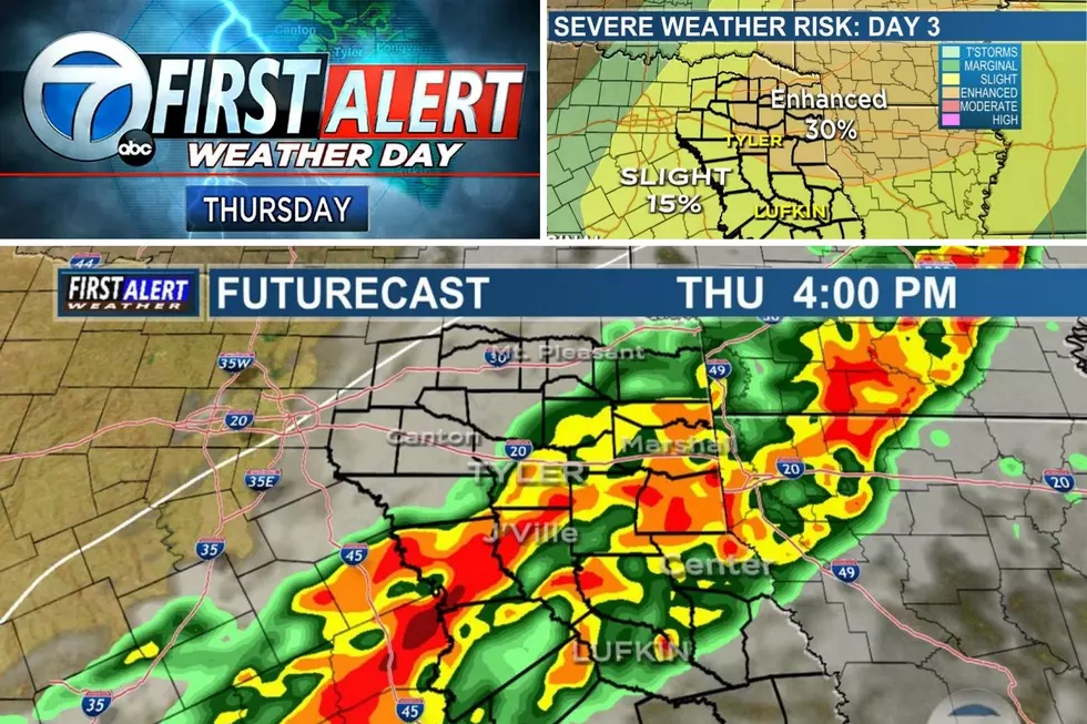
In all seriousness though, East Texas has the potential to catch anywhere from three to five inches of rainfall through Wednesday evening with some isolated locations seeing as much as seven inches of rain through Thursday. Because of all the rain that is expected in East Texas over the next couple of days, KLTV 7 Chief Meteorologist Mark Scirto has declared Tuesday and Wednesday as First Alert Weather Days.
The First Alert Weather Days have been declared because of the shear amount of rain that is expected. The moisture will be in place for this big rain event thanks to the strong southerly winds, an approaching cold front along with an upper level low pressure system that will be moving across East Texas. The cold front is expected to arrive in the northern sections of East Texas by early morning on Wednesday, central sections by midday and southern sections by Wednesday afternoon.
Before the cold fronts' arrival, we will see some rain, that will be heavy at times, on Tuesday but Wednesday is when the bulk of the rain is expected to fall. In conjunction with the cold front and the upper level low pressure system, some areas could receive an excessive amount of rain in a short period of time due to the 'training' of the storms. Training happens when multiple storms move across the same area and all the runoff from the storms could lead to flash flooding. If you are out driving and you encounter a roadway that has rushing water over it and you can't see the pavement, please, turn around. Don't drown.
These rainfall numbers could change due to how fast the front and low pressure system work their way through East Texas. Mix 93-1 and KLTV 7 will keep you updated on changing weather conditions here in East Texas especially of any kind of watch or warning.
More From 101.5 KNUE