Keep An Eye On Tropical Storm Cindy With The Interactive Flood Map
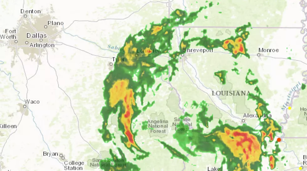
Tropical Storm Cindy made landfall along the Texas Louisiana border early this morning (June 22nd) and is bringing copious amounts of rain not only to East Texas but to Louisiana, Mississippi and parts of Alabama. With all the rain that is being forcasted to fall in these affected areas, the National Weather Service has issued Flash Flood Warnings for parts of Eastern Texas and throughout Louisiana.
You can follow along in real time with the storm and stay up to date on possible flooding throughout the region with an interactive map from the Environmental Systems Research Institute (ESRI). The map is continually updated with information from the National Weather Service, current radar information and river monitor station information. Another cool feature of this interactive map is that it allows users to display live or live update on flooding through social media features. Using social media platforms like Instagram, Twitter and Flickr and live video streaming via YouTube.
With interactive tools like this, we are able to be more informed and stay ahead of danger. Remember, when driving, if you encounter a flooded roadway, turn around don't drown. Just a little rushing water over the roadway can sweep your vehicle off the road, plus you don't know if the road has been washed out underneath the rushing water or what kind of debris you might encounter.
More From 101.5 KNUE