Wildfires in Australia Creating Their Own Thunderstorms
The wildfires in Australia continue to burn, however improvements have been made in the recent days. One thing that has caught the eye of many, is the fact that some of these fires are strong enough to produce their own thunderstorms.
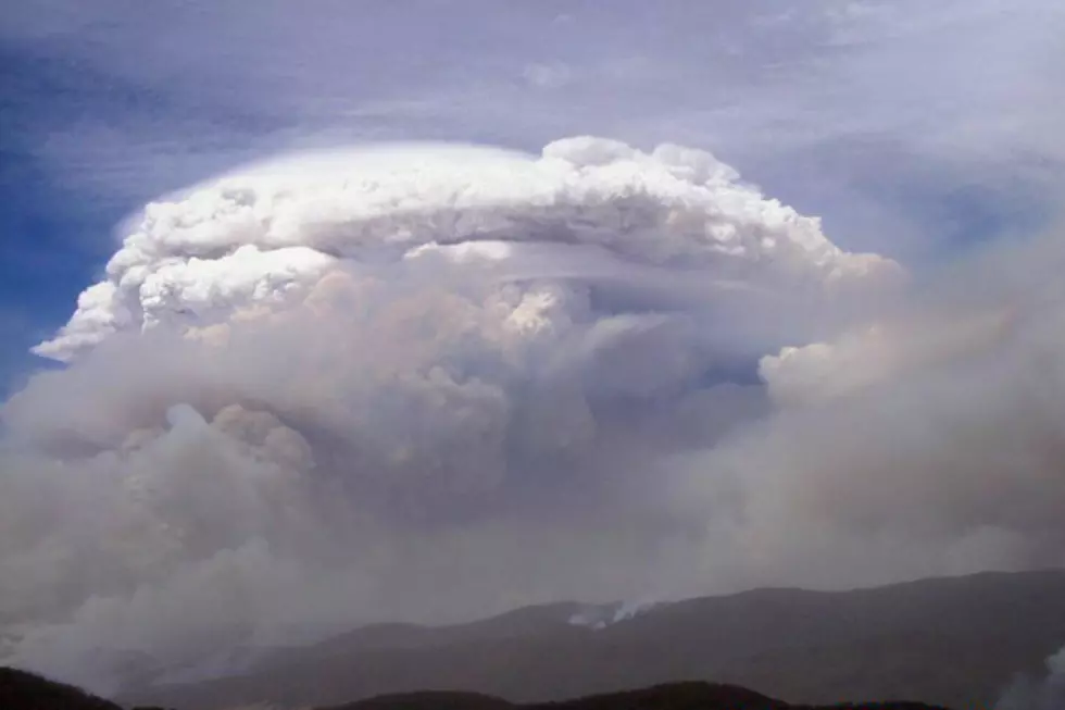
It’s called a pyro-cumulonimbus cloud. Similar to that of a thunderstorm, which are made up primarily of cumulonimbus clouds. The main difference though is that these pyro-cumulonimbus clouds are driven by the heat of the fire.
Thunderstorms form because of air rising through a storm. We call this an updraft. The fires however don’t have a traditional updraft of that of a thunderstorm. The hot air that’s rising up is cooling (somewhat) and condensing. This forms a smokey-like cloud. What’s left is an imbalance of very hot air at the surface, and relatively cooler air aloft. Though frankly the air aloft is still pretty hot. But in some cases there’s enough of an imbalance to produce a downdraft. This downdraft produces strong winds at the surface with help the fire to spread faster and make it harder to fight.
Another thing these fire driven thunderstorms can do is produce lightning. Because of the rising air and the downdraft in place, the chaotic winds within the pyro-cumulonimbus cloud separate the positive and negative charges. When that happens lightning can occur. Obviously this is already scary enough, but that lightning can spark new wildfires.
Because of the high heat within these fire driven thunderstorms, no rain falls. Any that would try to fall would simply evaporate very fast.
More From 101.5 KNUE