Hurricane Dorian Intensifies as it Heads Toward Florida
It’s already the strongest storm of this year’s Atlantic hurricane season, and it’s expected to get even stronger.
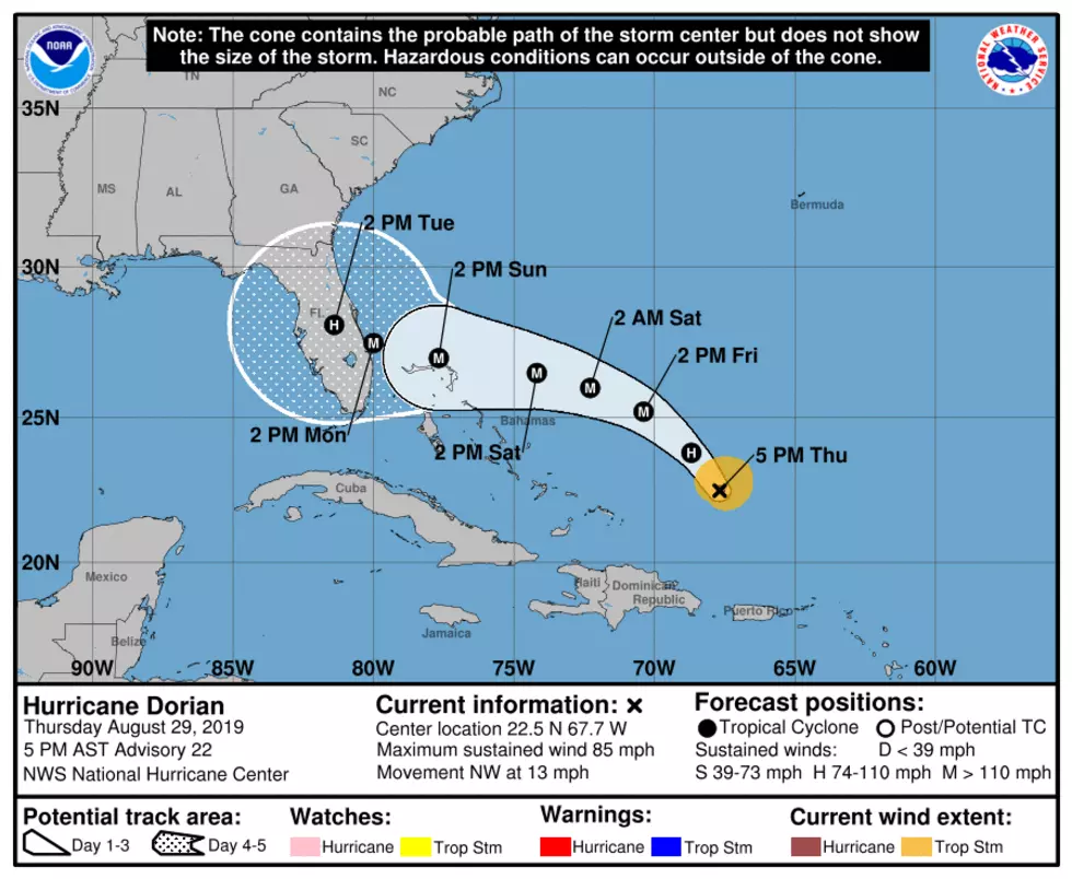
Hurricane Dorian is continuing to move north-northwest through the open waters of the Atlantic. As it does so, it continues to gain strength. The storm is forecast to strengthen to a Category 3 hurricane early Friday. At this point, it’s forecast to have sustained winds of 115 miles per hour and wind gusts of 140 miles per hour.
From there the storm turns a little more westerly Saturday and heads towards Florida. By early Sunday, the storm is expected to strengthen into a Category 4 hurricane with sustained winds of 130 miles per hour and wind gusts of 160 miles per hour.
Dorian is expected to make landfall just south of Melbourne, Florida on Monday later in the afternoon or in the evening as a Category 4 hurricane.
The Governor of Florida has issued a state of emergency ahead of the storm to ensure that local governments and emergency management agencies have the time, resources and flexibility to be prepared.
Dorian is expected to produce up to a foot of rain in some spots of the southeastern U.S. Dangerous storm surge is also possible, but the bigger threat with this storm appears to wind. Wind gusts could exceed 160 miles per hour. That’s equivalent to damage from an EF3 tornado, only these winds will be much more widespread.
The last time a hurricane made landfall in eastern Florida, was Hurricane Katrina back in 2005. That storm went on to devastate Louisiana and southern Mississippi.
More From 101.5 KNUE


